


By John Lee.
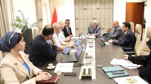
Iraq's Ministry of Planning held a technical meeting to advance work on the country's geospatial information management systems and national data platforms. The meeting was chaired by the Under-Secretary for Technical Affairs, Dr Maher Hammad Jouhan.
Jouhan said that developing the geospatial information system is a key pillar in supporting planning, sustainable development, and digital transformation efforts, and emphasised the importance of coordination among relevant bodies to build an integrated national spatial database to underpin decision-making and development policy.
The meeting covered:
- Preparations for a national workshop on the UN Integrated Geospatial Information Framework (UN-IGIF), and a review of progress on the national plan
- The current status of the National Spatial Data Infrastructure (NSDI) platform, legal and administrative procedures for its handover, and the identification of bodies responsible for its operation and sustainability
- Iraq's preparations for the 16th session of the UN Committee of Experts on Global Geospatial Information Management (UN-GGIM)
- Updates on the Sustainable Development Platform and Iraq's national presentation on the integrated geospatial information management framework, including recommendations and next steps
Attendees included the Deputy Head of the Statistics and Geographic Information Systems Authority, Dr Makki Ghazi Abd al-Latif; the Director General of the Information Systems Department at the Statistics Authority, Dr Fouad Flayih; the Director General of the Regional and Local Development Department, Dr Mohammed Mohsen Al-Sayed; a representative of the Ministry of Higher Education and Scientific Research, Dr Adai Zakaria; and a representative of the Ministry of Finance, Khaled Shaker.
(Source: Ministry of Planning)

No comments yet.